The lookout from the 280m summit of Mount Beerburrum is a short walk up a pathway that is paved from the parking area of the walk all the way to the top. It sounds like it might be an easy walk but it isn’t. I found Mt Ngungun ![]() easier, another Glass House Mountains summit walk, even though it is a rougher trail.
easier, another Glass House Mountains summit walk, even though it is a rougher trail.
At the top is a fire tower, of which you can climb part way to get a better view. Mt Beerburrum is fairly flat once you reach the top, and the extra height helps to see passed the greenery.
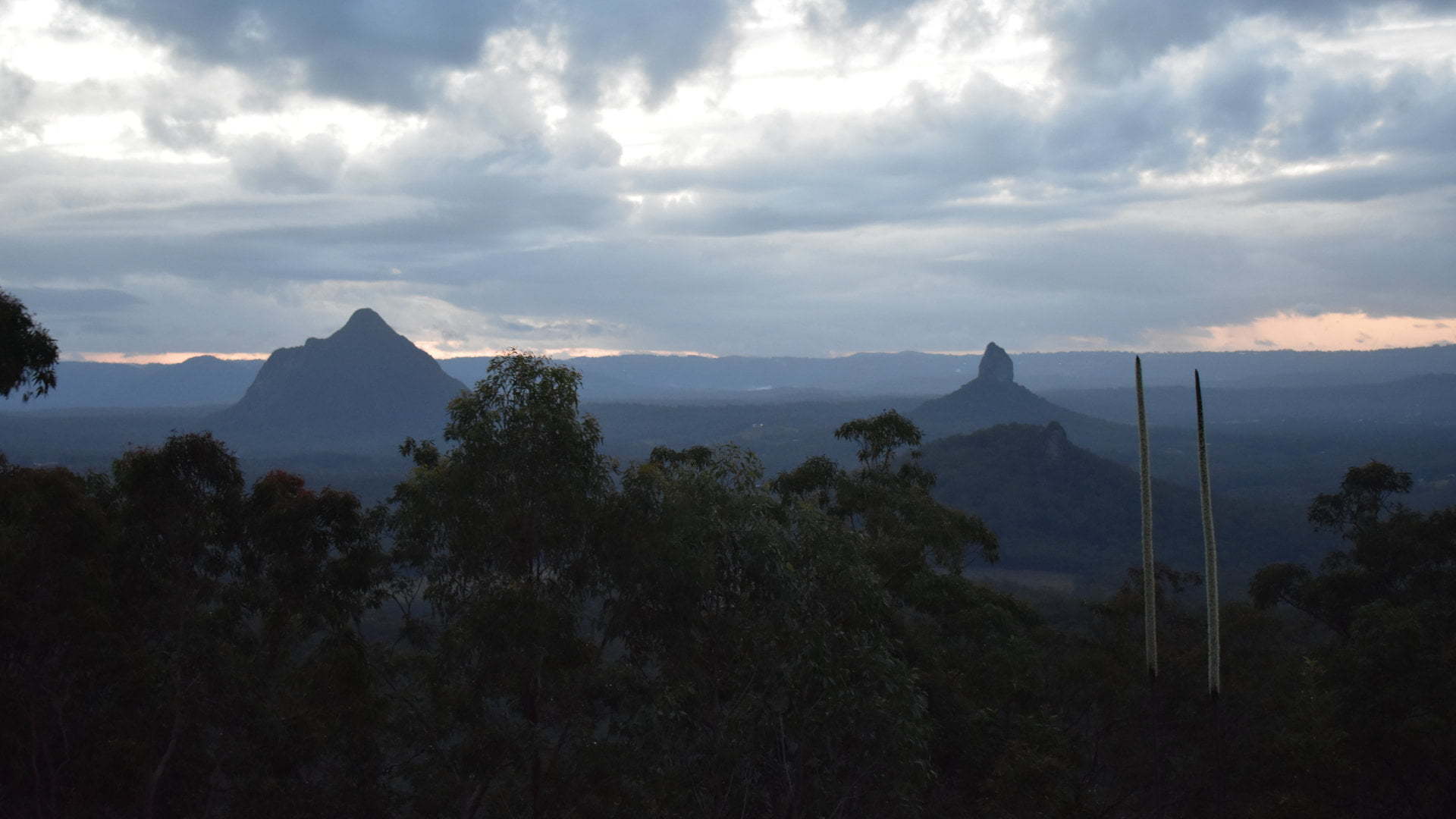
The views are in all directions. Mt Tibberoowuccum and Mt Coonowrin ![]() lined up with each other to the northwest and Mt Beerwah to the side. Mt Tibrogargan sits to the north, and Wild Horse Mountain
lined up with each other to the northwest and Mt Beerwah to the side. Mt Tibrogargan sits to the north, and Wild Horse Mountain ![]() to the northeast with Bribie Island and the ocean in the distance. The eastern twin of Mt Tunbubudla is seen towards the west with the mountain ranges in the background.
to the northeast with Bribie Island and the ocean in the distance. The eastern twin of Mt Tunbubudla is seen towards the west with the mountain ranges in the background.
Mount Beerburrum Lookout is a 150m climb, over a 700m walk to the fire tower. To describe the path as very steep makes it sound flat compared to how it feels walking up it. It is unrelentingly steep for the entire way, with some extra steep parts for good measure. There are some rock seats at a couple of spots on the way up if you need a rest.
 I found walking down worse, however, as it put a lot of strain on my knees and the constant effort to stop yourself going down too quickly. It started to rain on my way back down and I was worried about it getting slippery as it is already so steep, but it didn’t rain enough to cause a problem.
This was the second time up to Mt Beerburrum Lookout. It had been around 4 years since the last time, and I had forgotten how steep it was. I didn’t have my boys with me this time, but they did last time, the youngest had not long turned 5. It is steeper than Wild Horse Mountain which we did last year.
Allow plenty of time to climb Mt Beerburrum, and just as much time if not more to come back down and it isn’t too bad. I regard it as a safe walk, for children included, as long as the walk down isn’t rushed and take small and steady steps.
There isn’t much at the parking area, some seating and an information board. Part way down the track there is an information board about the Beerburrum District Hospital built after World War 1 and opened in 1922, which used to be located at the site of the sign.
The hospital was broken up in the 1930s and transported by road to expand Maleny Soldiers Memorial Hospital and Nambour Hospital.
It was dark by the time I saw this, so I didn’t have a chance to have a look around to see if there are any remnants. There isn’t any provision for stopping there, so you just have to keep to the side of the road as best you can so other vehicles can get passed you.
To get there:
 From Steve Irwin Way (take exit 163 heading north on Bruce Hwy, or exit 188B heading south), turn into Beerburrum Rd for the Beerburrum township, with the brown sign for Mt Beerburrum Lookout. Follow Beerburrum Rd for 850m, and turn right into Mount Beerburrum Access, with another brown sign. The parking area is 700m along Mount Beerburrum Access.
From Glass House Scenic Lookout, head towards Old Gympie Rd for 2.8km east on the bitumen road. Turn right into Old Gympie Rd and continue for 2.3km, and turn left into Beerburrum Woodford Rd and follow for another 4km to the end. Turn left at Beerburrum road, then after 170m turn left into Mount Beerburrum Access, with the brown sign. The parking area is 700m along Mount Beerburrum Access.
From Mt Ngungun, head west along Fullertons Rd for 1.2km to Old Gympie Rd, and turn left into Old Gympie Rd. Continue for 5.4km, and turn left into Beerburrum Woodford Rd and follow for another 4km to the end. Turn left at Beerburrum road, then after 170m turn left into Mount Beerburrum Access, with the brown sign. The parking area is 700m along Mount Beerburrum Access.
Cost: Free
Hours: Anytime
Toilets: No
Bins: No
Tables: No
Seating: Yes
Water: No
Food: No
Wheelchair accessible: No
Pets: No
BBQ: No
Playground: No

