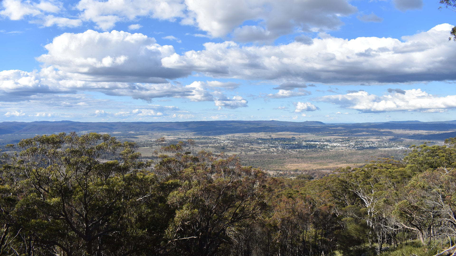
Mt Mackenzie Lookout is located in the Mount Mackenzie Nature Reserve near Tenterfield in northern New South Wales.
At 1,298 metres above sea level, the lookout has views to the east over Tenterfield and the mountains across the Queensland border in the distance.
Mount Mackenzie is named after Scottish born Robert R Mackenzie, who took up Tenterfield Station for Stuart A Donaldson in 1840. Robert Mackenzie later moved to Queensland where he became the first Queensland Colonial Treasurer and the Queensland Premier in 1867.
Much of the country area seen from the lookout was part of Tenterfield Station. Until the 1870s, all wool from the area was transported east over the ranges by bullock teams, what is now the Bruxner Hwy, to the Clarence River to be shipped by river to Grafton and Lawrence.

The railway reaching Tenterfield in 1886 changed long-distance transport with a link through to Newcastle and unaffected by floods. The Tenterfield Railway Station ![]() , now a museum, is on the closest fringes of the town viewed from the lookout, along with the Tenterfield Cemetery.
, now a museum, is on the closest fringes of the town viewed from the lookout, along with the Tenterfield Cemetery.
Prominent features in the views from left to right include Doctors Nose, another mountain near Tenterfield and Wallangarra where the railway continued north to cross the border to Queensland.
The mountain range in the distance sits across the Queensland border with Mt Norman in Girraween National Park and flows onto Bald Rock National Park and Boonoo Boonoo National Park in New South Wales. The mountain range flattens after the final peak seen with Woollool Woolloolni Aboriginal Place.
The lookout sits at the back of a large rock face that slopes gently towards the steeper ledge, limiting trees from growing in front of the lookout and keeping a great clear view.
Added as a bicentennial project in 1988, the facilities at the lookout make it a great place to stop for lunch with a decent sized shelter with a picnic table and free BBQ. The view from Mt Mackenzie Lookout is a wonderful accompaniment for enjoying a meal break.
To Get There

From Tenterfield Visitor Information Centre, head south along the main street (New England Hwy) 200m and turn right into Douglas St at the brown sign for Railway Museum. Follow Douglas St for 1.5km to the end and turn left, then the next right into Mount MacKenzie Rd. Follow Mount MacKenzie Rd for 6.9km and turn left into Gum Flat Rd. Gum Flat Rd is a dirt road but is in good condition and suitable for any vehicle. Follow Gum Flat Rd for 1.2km and turn left into Mount Mackenzie Lookout Rd, which returns to bitumen and is bitumen for the rest of the way.
Mount Mackenzie Lookout Rd is steep in some sections but not drastically so. Camper trailers or smaller caravans should not have troubles, however, be aware there is not much parking once you reach the top. The parking area has a loop so turning around should not be a problem.


