The World War II Historical Site is at the Gunpowder Rest Stop on the highway between Mount Isa and Camooweal, with historical information about the road and its significance in the war and overnight free camping.
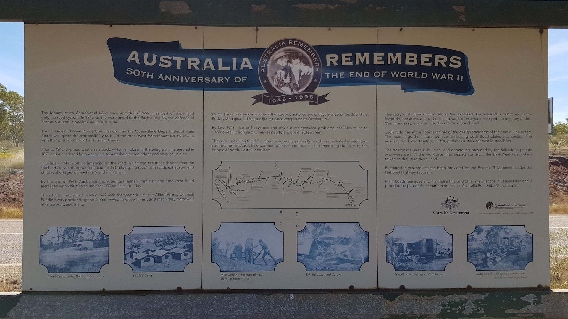
The road between Mount Isa and Camooweal was built as part of the inland defence road system as an urgent project to improve the defence of northern Australia with World War II moving to the pacific region in 1940.
Before the road was built, there was only a track along the telegraph line built in 1897. The track ran along ridges and between waterholes rather than a direct line. The new road cut 10 miles (16 kilometres) off the length of the track.
The building of the road was hampered by budgeting problems and a shortage of heavy machinery. It was completed in 1943, virtually working around the clock.
Known by the locals as Tojo’s Highway because it was funded by Americans, it was the link between the southern states and the potential front line of the Northern Territory.
The section of road at the site has been upgraded again in 1994. The construction differences are in contrast. The earlier road follows the natural surface of the land, through flood plains and over crests.
The rest area has been donated by the Kalkadoon people who were part of the workforce that helped construct the road.
The section of road and site is being preserved by Main Roads in memory of the fortitude, persistence and hard work of everyone involved.
The rest stop has toilets, a sheltered picnic table and BBQs for use. There is plenty of space for camping overnight with a two night limit.