The Border Ranges National Park is a rainforest park in New South Wales on the rim of an ancient volcano, adjoining the Lamington National Park in Queensland.
The Border Ranges forms the western edge of the caldera of the extinct Tweed shield volcano, the largest caldera in the southern hemisphere. The Tweed volcano was over 100km wide and spread out from Lismore to Mount Tamborine, and Byron Bay to Border Ranges. Mt Warning is the lava plug remnants in the centre of the volcano.
Some of the features within Border Ranges National Park have their own brown signs, so those are described in their own page:
- Border Loop Lookout
 – in a separate section of the park at the northern end and the NSW and QLD border
 - The Pinnacle
 – an outstretch of rock into the caldera of the Tweed Volcano, the best views at the Border Ranges
 - Sheepstation Creek Campgrounds
 – largest of two campgrounds with sites for tents, camper trailers, & caravans
 - Brindle Creek
 – a small picnic area with walks along Brindle Creek, Helmholtzia Loop Walk, and the Red Cedar Walk
 - Antarctic Beech
 – a great spot to stop for lunch with picnic tables, wood BBQ, toilets, and views to the QLD border
While some features have their own signs, there are more features in the Border Ranges National Park.
Bar Mountain Picnic Area

This location has been used as the map position for Border Ranges National Park. There are three walks at Bar Mountain, the main walk is Bar Mountain Circuit.
Bar Mountain Circuit is a 4km grade 3 walk that winds its way down the ridge to the western escarpment through giant eucalypt forest. The lookout provides a panoramic view of Collins Creek, Mount Lindesay and Mount Barney. The walk takes about 2.5 hours, depending on how much time you spend taking in the views, passing through cool temperate rainforest, subtropical rainforest, and dry escarpment.
A shorter walk starts along the Bar Mountain Circuit through the cool temperate rainforest and returns on the Falcorostrum Loop. The Falcorostrum Loop gives a taste of the eucalypt forest and ancient mossy Antarctic Beech trees in 650 metres taking up to 30 minutes. The loop is named after the beech orchid, Dendrobium
The third walk is the Beech Glade walk, the shortest of the three walks, only 150 metres return. The walk isn’t long but has a number of large and impressive ancient Antarctic Beech trees, over 2,000 years old.
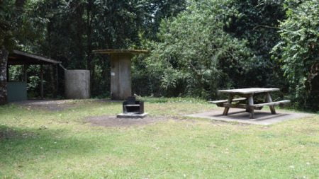
The picnic ground has a sheltered picnic table with a fire place and BBQ, a couple of additional picnic tables outside, and longdrop toilets.
Blackbutts Lookout

Blackbutts Lookout provides a good view of the caldera of the Tweed shield volcano and the lava plug remnant, Mt Warning at the centre.
The Springbrook plateau and Limpinwood Nature Reserve is at the northern end with Lamington National Park between, and Jerusalem Mountain and the Nightcap Range to the south.
The Pinnacle provides a better view, however, as it sticks out from the escarpment removing the vegetation from blocking some of the views.
The morning we were here the air was still hazy, so we didn’t get the best view Blackbutts Lookout has to offer.
The area has a couple of picnic tables and a longdrop toilet. Either side of the lookout has a massive Blackbutt tree.
Forest Tops Campgrounds

Forest Tops Campgrounds is one of two camping areas in the Border Ranges National Park, the other being Sheepstation Creek Campgrounds.
Forest Tops is a small walk-in only campground with three sites. Bookings for camping can only be made online or by calling National Parks. Weekends can be popular so it is best to check ahead of time if you know you are going there.
At a high altitude, Forest Tops is just about guaranteed to provide cool to cold nights, even during the summer months.

The Booyong Walking Track starts at Forest Tops Campgrounds following a historic trail through lush rainforest to Sheepstation Creek Campgrounds. One way is 9km so ensure you have enough supplies for a long day (5-6 hours each way) or arrange for a pickup at the other end.
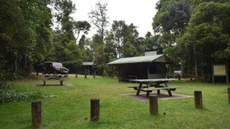
Forest Tops Campgrounds has a free gas BBQ with a shelter over it. Wood BBQs are there too, one of them in a larger shelter with a large picnic table.
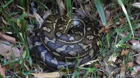
Near the start of the Booyong Walking Track, we found a python coiled up having a sleep. A camper at Forest Tops said it had been around for a few days but moved since they last saw it.
To get there
Border Ranges National Park directions are to the Bar Mountain Lookout. See Sheepstation Creek Campground ![]() for other alternate directions into the other end of the park.
for other alternate directions into the other end of the park.

From
From Murwillumbah, head towards Uki on Riverview St which becomes Kyogle Rd. Once out of town, follow Kyogle Rd for 39.9km and turn right


