Kroombit Tops is a national park in a rugged area north of Monto and Cania Gorge National Park, south-west of Gladstone and east of Biloela. The park is accessible to conventional vehicles however to see the whole park a high clearance 4wd is recommended.
There are three entrances to Kroombit Tops National Park. Conventional vehicles need to enter at the north-eastern part of the park, coming in from either Gladstone or Ubobo in the Boyne Valley.
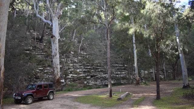
We entered the park from the south-eastern part of the park from Cania Gorge, going through the farmlands and along Munholme Creek before reaching the entrance. The track then climbs to the top of the shelf mountain tops of Kroombit Tops, arriving at an information board and an old log snigger near it.
The track is not difficult but there are a couple of sections before the climb up with the centre of the track is raised and could make it challenging for low clearance vehicles. The track is rough in sections and has some parts that are steep but is an easy track for most four-wheel drives.
Behind the log snigger and information board, there is a track that leads down the hill. We walked about 1km down but there wasn’t much to see and turned around and came back. It appears it used to be a vehicle track and has long been closed.
From the log snigger, the four-wheel drive section continues for 5 or 6 kilometres further to the Rainforest Walk where the road becomes noticeably smoother where conventional vehicles can drive to.
Rainforest Walk
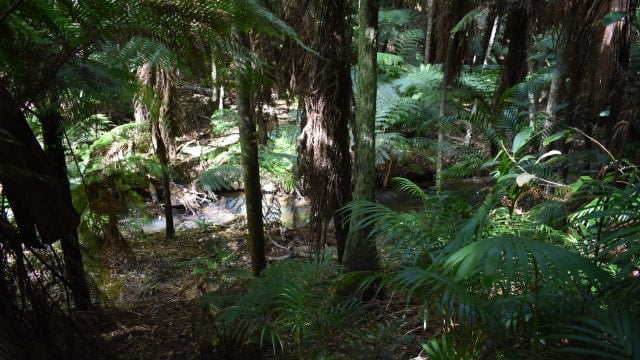
The rainforest walk takes you through the damp and shaded rainforest at Kroombit Tops. The forest is typical of subtropical rainforests but has plants found in temperate rainforests further south due to the cooler high elevated location of Kroombit Tops.
The 300 metre walk is a fairly narrow trail starting with thick scrub vines and leading down to a creek surrounded with ferns and palms. The temperature was noticeably cooler as we walked down closer to the creek.
There are some steps and some gentle slops along the track and although the track is not well defined in parts it is easy to follow.
The Lookout
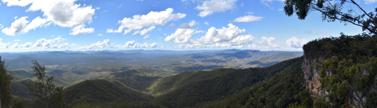
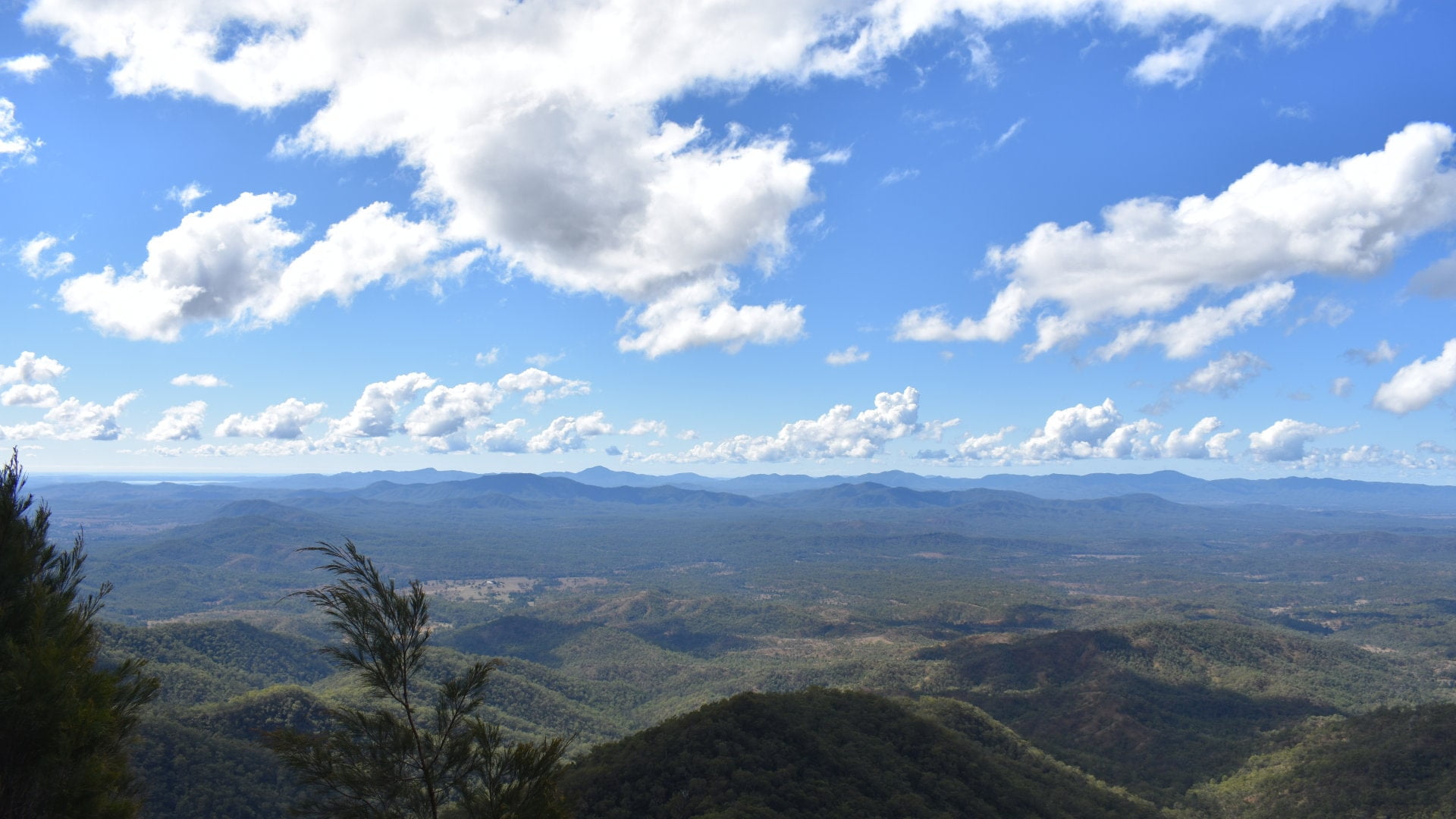
2km north of the Rainforest Walk you will arrive at The Lookout. Views from the escarpment are seen just before arriving at the parking area for the lookout, with the road not far from the cliff edges.
The Lookout is the only location in Kroombit Tops with toilets, so it also makes for a good stop for some lunch with a couple of picnic tables.
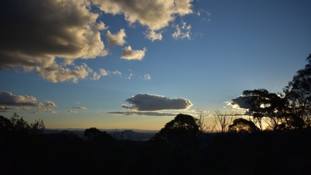
The highlight, however, is the view from a platform on the edge of the cliffs, about 100 metres from the parking area. The view looks eastward, with Lake Awoonga towards the north-east, Mount Stanley, the Boyne Valley to the east, Mount Robert, and Mount Fort William to the south-east, and the exposed rock cliffs of Kroombit Tops framing the view to the right.
Escarpment Track
From the lookout is the Escarpment Track. This is a 13km track one-way that takes about 5 hours. It follows the eastern escarpment through open blackbutt forest and glimpses of views towards the Boyne Valley.
A support vehicle will be needed to complete the whole walk as it is not a circuit. You could walk a part of the Escarpment Track and return to the same spot if you don’t have a support vehicle available.
Beautiful Betsy – Liberator Bomber Crash Site
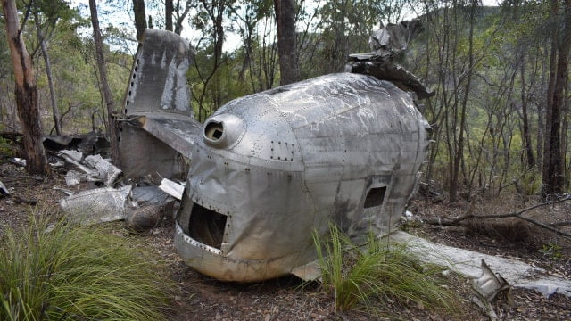
Beautiful Betsy was an American World War II B-24D Liberator bomber and named after the original pilot’s wife Betsy. There were more B-24 bombers built than any other allied bomber in World War II and used by American, British, Candian, and Australian air forces.
Betsy took part in 25 missions in eight months of active service. After being overstressed from a storm and separately received damage from a difficult landing, Betsy was disarmed and ran “fat-cat” runs in Australia, taking supplies like ice-cream and alcohol to military personnel.
Beautiful Betsy left Darwin 26th of February, 1945 for Brisbane but never arrived. Betsy remained a mystery for nearly 50 years when a ranger stumbled upon the site during burning activities in July 1994.
The drive to Beautiful Betsy is at the end of a four-wheel drive road called 4WD Loop Road, 4.7km from The Lookout. 2.5km in there is a fork in the road which you have to continue to the left, as the other track is the end of an optional one-way section to return on.
The track continues for another 15km before reaching a turn to the left to head towards the bomber. The track is well signposted and the condition of the track was great all the way to here. The track then narrows with a steep hill climb that is supported with wooden slats across the track for traction.
The hill is not difficult but is steep and you need to be wary of traffic coming the other way. We didn’t have any problems with it, however, when we left we did notice a vehicle that arrived after us, had left wheel spin black marks on the wood slats and had obviously had more trouble.
A large parking area is reached and the rest of the way is on foot. The walking section is easy to do, mostly with mild slopes but there is a part with large steps.
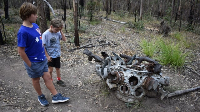
Beautiful Betsy is still strewn all over the place, more or less left as it was when it was discovered over 20 years ago. You are soon led to the largest intact part of the aircraft, a section of the tail flanked by sections of the wings.
Most of the aircraft disintegrated spreading out in small parts. The engines, being heavier, continued 100 metres further up the hill along with some radio equipment and one of the undercarriage.
Information boards lead you through the wreckage and tell the story of the crash as well as it is known, including the history of Beautiful Betsy and information about the crew.
The Wall Camping Area
Return from the bomber site is the same way as coming in, turning right at the junction after coming back down the steep hill with the wood slats across it.
For higher clearance vehicles an alternative one-way track takes you passed The Wall campground before rejoining at the fork mentioned earlier.
It starts to descend down a steep loose rocky track which continues downhill for about 1km. The track is easy in low range to control descent and leads to a creek with the opposite side a rock wall that gives the campground its name.
Another couple hundred metres further on, still next to the creek, is a larger and little more open area that is better for camping at than the part you first see. It is also off the road a little so less likely to be disturbed by passing traffic.
From The Wall, the Loop Road has a nice view to stop at along the way before reaching the fork.
Griffith Creek Camping Area
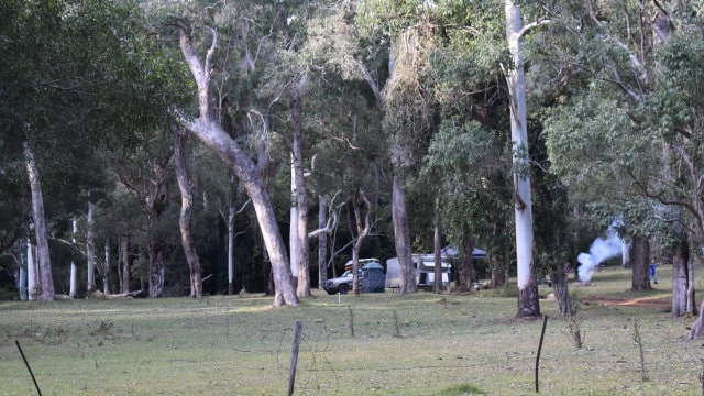
Griffith Creek is a day use area on one side of the road and a camping ground on the other. Griffith Creek is the only camping area that is permitted access with conventional vehicles.
The day use area has some picnic tables, but otherwise, there are no facilities at Griffith Creek, so you need to be self-sufficient.
Razorback Track Camping Area
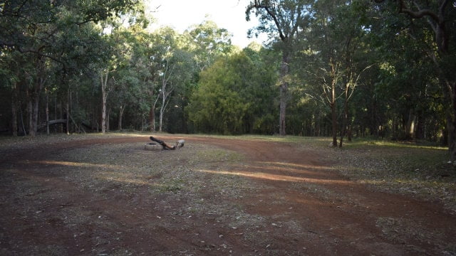
Razorback Camping Area is a short way into the Razorback Track. It is a very small camping area and wouldn’t support many campers. Razorback Track is 4WD only so it may be more private being more restrictive access. There are no facilities.
Trailers are not allowed on Razorback Track, however, they are permitted up to the camping area.
Razorback Track
Razorback Track is a 4WD only track for vehicles with higher clearance and low range. The track is not difficult but it is more difficult than the south-eastern entrance and the one-way section of the Loop Track. There are some very steep sections with loose surfaces.
The signs
Razorback Track is 27kms from the start at Tableland Rd through to the western entrance near Valentine Plains towards Biloela. The track takes a long while to complete, so allow plenty of time.
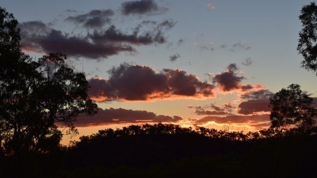
It took us 2 hours to complete and we ran out of daylight, missing out on looking at the Marble Waterhole towards the end of the track. On the flip side, we saw some beautiful sunset views while still high on Razorback. Negotiating the later tracks in the dark was a little challenging on an unfamiliar road, however, the signs were sufficient to put us on the right path.
You realise just how high you are on Kroombit Tops when for so long you are driving down steep sections of track. There is a part where the left of the ground drops sharply to the left and you look to the right and it does the same there as you are driving along a narrow ridge.
There are opportunities to stop for views on the way, with one spot where the track leads towards a cliff looking south and the track swings to the right before heading down again. The cliff is at an open clearing giving unobstructed views.
Eventually, the track reaches the creek and turns to head back up again. Heading in this direction, it was the steepest climb.
The track then comes back down to the creek level and follows along the creek bed for a while, until eventually reaching a gate where access through private property is required to exit the park.
Summary
Kroombit Tops is a fantastic destination. Having a 4wd vehicle will let you get the most out of it as it will let you get to parts that are not accessible otherwise.
We did Kroombit Tops in a single day, and it is a long tiring day. We left from BIG4 Cania Gorge around 8am and stopped for a pie at a servo in Thangool at 6.30pm before getting back to camp at around 8pm that night.
Driving Razorback Track in the other direction would be more fun, climbing the hills instead of coming down them, but the views from The Lookout would have been more in shadow from a later sun.
Overall I think the route we took to do Kroombit Tops was the preferred way unless you camp overnight then I’d rather do it in the other direction.
Kroombit Tops has been one of my favourite destinations with Brown Signs. It has a lot to offer with stunning views, some great off-road driving in the spirit of accessing areas that are not accessible by conventional vehicles, and