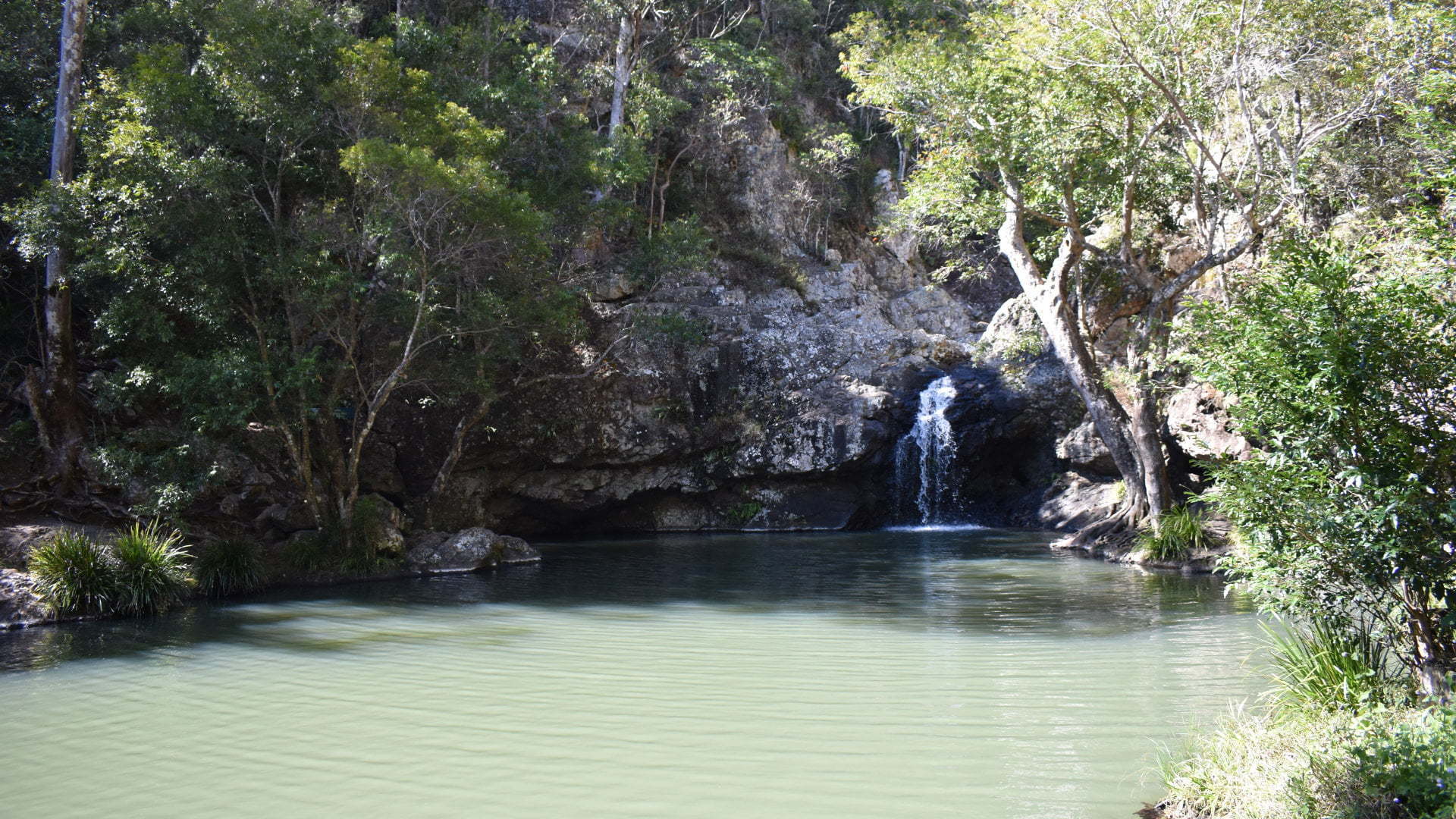
Kondallila Falls near Montville is an 80-metre waterfall with a natural rock pool at the top of the falls. The main walk to the falls leads to the top of the falls, with a longer walk down to the bottom of the falls and back around to the other side at the top.
Kondalilla is an aboriginal word meaning “rushing waters”.
Kondalilla Picnic Area
 The first thing to come across on the walk is the picnic area, about 100m from the parking area down 40 stairs and steep ramps. The picnic area has picnic tables, some of them sheltered, and free BBQs. There is lots of open grassy area too, but a lot of it is sloped ground. The toilets at the picnic area are the only toilets in the national park, so it is good to stop on the way before continuing on the walk.
Picnic Creek Circuit
 The Picnic Creek Circuit is a 1.7km grade 2 walk, and is part of the Rock Pools Walk and the Kondalilla Falls Circuit walk.
The walk starts from the picnic area taking you through the forest arriving at Picnic Creek only 100m or so from the picnic area. The creek has a small waterfall a few metres from the bridge over the creek. The waterfall was a little more than a trickle.
On the other side of the bridge are some steps, then it splits into two different paths. This is where the circuit part of the walk is. It doesn’t matter too much which way you go, especially if you walk the circuit. You can take either way to continue to the Kondalilla Falls Circuit or the Rock Pools Walk as it rejoins at the same point to continue to those walks so you can return on the other path.
 The right hand higher track leads to a lookout about 550m further on. The lookout has views over the valley the falls flow into, which you walk down to on the Kondalilla Falls Circuit walk.
I little after the lookout is the trunk of a dead tree that is split open down the side of it. The opening is big enough for an adult to stand in and our group took turns to climb up into the tree for a photo.
Shortly after here the circuit returns back towards the picnic area taking a lower path on the side hill rejoining back at the bridge over Picnic Creek.
Rock Pools Walk
 The Rock Pools Walk continues on from near where the split tree trunk is on the Picnic Creek Circuit. It is only 400m further but it becomes more difficult with 140 or so steps leading down to the top of Kondalilla Falls.
Other than the constant steps the track is easy enough and the fencing for safety is useful for using as handrails. Before reaching the rock pools another track heads to the right down a long steep set of stairs, which is the start of the Kondalilla Falls Circuit walk.
Continuing down the last few stairs you arrive immediately at the rock pools. At the back of the main rock pool is a small waterfall and at the opposite end a bridge over to the other side of the creek, and is the other end of the Kondalilla Falls circuit walk.
Before crossing over the bridge is a large open rock face which you can walk across and look at the rock channel leading to the main Kondalilla Falls which themselves can’t be seen from here.
There were plenty of people around taking in the beautiful sight that the rock pools are. It was warm in the sun but being August there were no brave souls going in for a swim, but you can swim in these rock pools.
The Rock Pools were the favourite part of the Kondalilla Falls National Park and we enjoyed them more than viewing the falls and the rock pool below them.
Kondalilla Falls Circuit Walk
 The Kondalilla Falls Circuit Walk extends further from the rock pools to take you to the bottom of Kondalilla Falls. Starting from the stairs above the rock pools, the track heads steeply down a set of stairs. It follows along the edge of the cliff to a lookout about 200m from the start of the stairs, with a safety rail along the way.
The lookout is from the path looking directly towards the falls, and the rock area at the rockpools above the falls. To see the bottom of the falls requires to continue on the walk as they can’t be seen from the lookout.
Continuing on the walk is noticeably more difficult with steeper stone steps and no more safety rails. And there are lots of steps. To reach the bottom of the falls, heading in a clockwise direction is the shortest and quickest way, but it heads down quickly zig-zagging back and forth.

There is a part reaching the bottom of a set of steps and continues forward on flatter ground that if you look back there is a track that heads back the other way with a very narrow part beside the steps and the cliff. We walked up this to find that it goes nowhere. It is narrow and heads back uphill, turning to the left and up more stairs before it becomes nothing. It is likely the old path before it was re-routed. We were not the only ones to see where this leads with just about everyone doing the same which keeps it in a well-used appearance.
Continuing on the track eventually reaches the bottom to meet the creek. The track detours 100m to the base of the falls and the rock pool below it. There was not a lot of water flow so the rockpool was not too big. The last part is a scramble over large boulders to reach the rock pool but you can see the waterfall without going all the way to the rock pool.
Returning to the creek, a bridge takes you across to the other side to start the climb back up, and the junction for the Sunshine Coast Hinterland Great Walk. The Great Walk is an additional 9.1km one way from here, coming out at the southern end of Kondalilla National Park ![]() , which is the start of the 58km walk.
, which is the start of the 58km walk.
Flat Rock is 2.2km from here, or 4.4km return if you want a longer walk. Otherwise organising a pickup at the other end to do the complete Kondalilla National Park section of the Sunshine Coast Hinterland Great Walk.
The path continues uphill, then mostly levels out heading back towards the rockpools at the top of the falls. Before reaching the rockpools the track follows close to the cliff with a safety rail providing some great views down the valley.
To get there:
 From Steve Irwin Way in Landsborough, turn into Railway St, and after 300m turn left into Maleny St and cross over the railway line. In 800m, continue straight ahead, through the roundabout into Landsborough Maleny Rd. The climb is steep for a few kilometres, and after 9.7km, turn right into Maleny-Montville Rd. Continue for another 10.1km, which becomes Balmoral Rd then Main street. Continue through the town of Montville, becoming Montville Mapleton Rd, for another 3km and turn left into Kondalilla Falls Rd with the brown sign for Kondalilla Falls National Park. Follow Kondalilla Falls Rd for 850m to the car park.
Cost: Free
Hours: Sep-Apr 5.30am-6.30pm, May-Aug 6.30am-5.30pm
Toilets: No
Bins: No
Tables: Yes
Seating: Yes
Water: No
Food: No
Wheelchair accessible: Yes, but not the walk to the bottom of the spillway
Pets: No
BBQ: No
Playground: No

